A rare bound collection of large-scale topographic vistas by Nineteenth Century America’s most successful viewmaker, John Bachmann Sr (1814-1896), more than doubled its high estimate to sell for $35,000. “Panorama of the Seat of War” comprised a portfolio of six double-page chromolithographed panoramic perspective maps of Confederate states. The panoramic map became a popular and effective technique for conveying information about the Civil War.
Review by W.A. Demers, Photos Courtesy Swann Auction Galleries
NEW YORK CITY – A rare bound collection of six spectacular large-scale topographic vistas by Nineteenth Century Americas most successful viewmaker. John Bachmann Sr (1814-1896) more than doubled its high estimate to sell for $35,000 at Swann Auction Galleries’ sale of maps and atlases, natural history and color plate books on June 23. “Panorama of the Seat of War” comprised a portfolio of six double-page chromolithographed panoramic perspective maps of Confederate states. Included were bird’s-eye views of Virginia, Maryland, Delaware and the District of Columbia; North and South Carolina and part of Georgia; Florida and part of Georgia and Alabama; Louisiana, Mississippi, Alabama and part of Florida; Kentucky and Tennessee showing Cairo and part of the Southern states; and Texas and part of Mexico.
Bachmann was a Swiss-born lithographer and artist best known for his bird’s-eye views, and the panoramic map became a popular and effective technique for conveying information about the Civil War. Early in 1861, Bachmann of New York City conceived the idea of producing a series of bird’s-eye views of the likely theaters of war. These visually attractive panoramas were easily understood and perhaps more meaningful to a public largely unskilled in map reading.
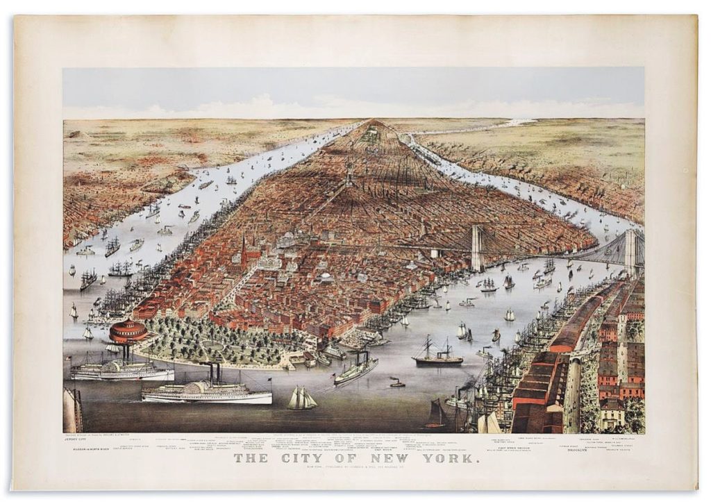
Still a bird’s-eye view but relegated to a smaller patch of US real estate, a Currier & Ives after Charles R. Parsons and Lyman Atwater map of the City of New York, 1876, realized $15,000. The large chromolithographed aerial panorama of New York City with scores of locations referenced below the image stretched 27½ by 39¼ inches sheet size, with wide margins. Overall, it was deemed an outstanding example of an exceptional print.

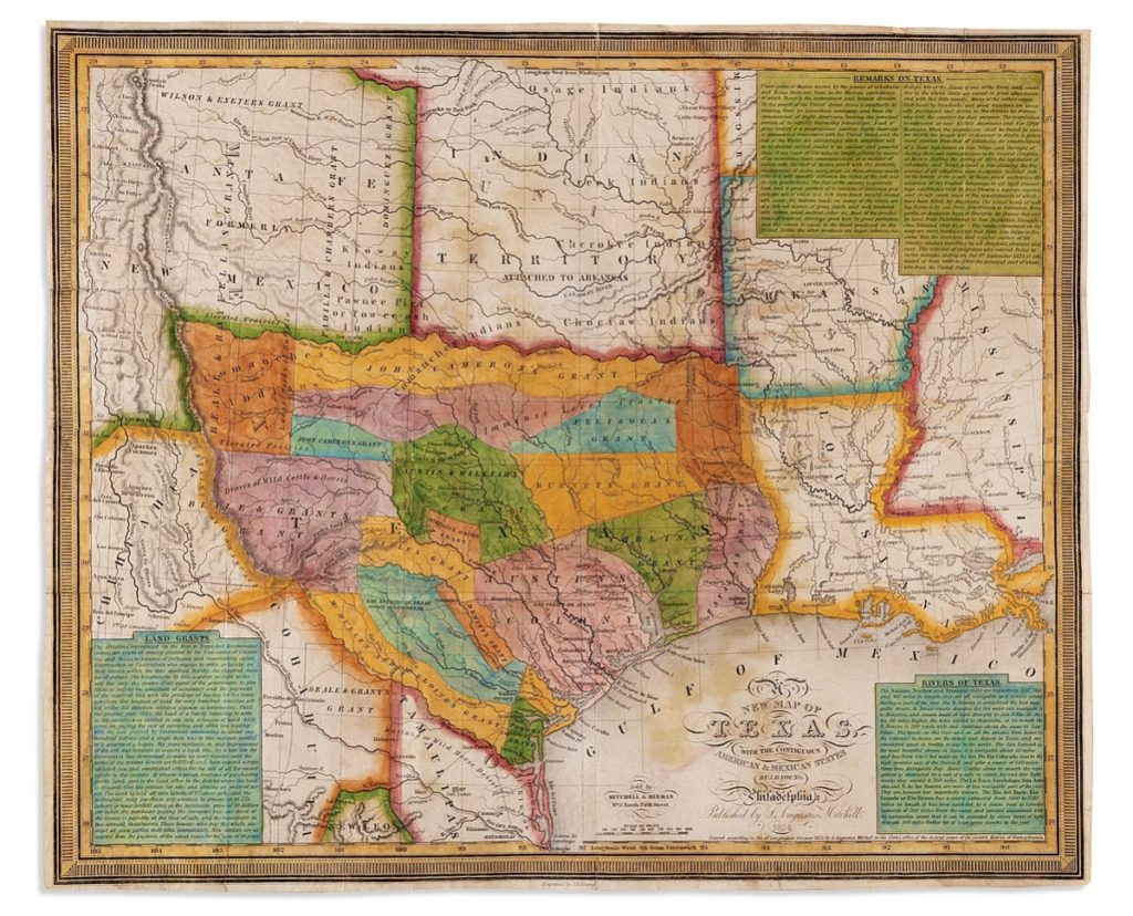
Texas in its first year of sovereign independence was depicted in this early hand colored and engraved map by James Hamilton Young, showing the contiguous American and Mexican states. Featuring inset text panels relating information on its rivers, original empresario land grants and general remarks on the country and regional politics, it measured 13 by 15½ inches and went out at $11,875.
Navigating Texas in the first year of the republic’s sovereign independence was aided by an early map by James Hamilton Young. A New Map of Texas, with the contiguous American and Mexican states was hand-colored and engraved, and featured inset text panels relating information on its rivers, original empresario land grants and general remarks on the country and regional politics. Measuring 13 by 15½ inches sheet size, with narrow margins, the 1836 map went out at $11,875.
An 1846 map of Texas, Oregon and California by Mitchell, S. Augustus took $10,000. The engraved pocket map of the American territories west of the Mississippi River measured 22¾ by 21 inches overall and was accompanied by a 46-page descriptive booklet. An important emigrant guide map to the west, and one of the first widely circulated maps of early Texas statehood, the map exerted great influence, not only with the public but on other commercial cartographers.
Another panorama of New York City depicted turn-of-the-Nineteenth-Century lower Manhattan observed across the East River from a small wooden dock on Brooklyn Heights. Most notably, a brilliant white horse is shown quietly grazing under an ancient tree in this very rare first state example, which was later reengraved in favor of the more commonly seen picnic party. William Birch and Samuel Seymour’s The City of New York in the State of New York, North America, hand colored engraved view, 1803, was bid to $9,375.

A bird’s-eye view by Currier & Ives after Charles R. Parsons and Lyman Atwater of the City of New York, 1876, realized $15,000.
Turning south, an influential map of Mexico, Texas and the American Southwest during a period of great political boundary dispute within that region was documented in Henry Schenk Tanner’s A Map of the United States of Mexico, As Organized and Defined by the Several Acts of Congress of that Republic. The large, hand colored lithographed map of Southwestern North America with an inset plan of the roads from Vera Cruz to Mexico City and two tables of statistics comprised two sheets that were joined to measure 23½ by 29½ inches overall. It brought $6,500.
European mapmakers shared notable lot honors with an unusual and scarce edition of Abraham Ortelius’ Typus Orbis Terrarum, Antwerp, 1598, a double-page engraved map of the world, going out at $6,250. With Dutch text on verso, the original hand colored map had been professionally conserved with repairs to its margins and centerfold. There were early ink mathematical notations on the blank side of verso and it measured 16¾ by 20½ inches sheet size.
From 1701, an allegorical highlight was an elaborate double-page etched and engraved title by Romeyn de Hooghe and 31 (of 32) double-page etched and engraved maps detailing property division in the Voorne region of southern Holland. At 21 by 15 inches, the portfolio finished at $6,500.
Prices given include the buyer’s premium as stated by the auction house. For more information, www.swanngalleries.com or 212-254-4710.


