Henry Popple’s 1773 A Map of the British Empire in America was the top lot in the 275-lot sale, realizing $60,000. It was the first large-scale, detailed mapping of British, French and Spanish colonial possessions in North America.
Review by W.A. Demers, Photos Courtesy Swann Galleries
NEW YORK CITY – Maps of Colonial America, those charting the nation’s westward expansion and Revolutionary era battle plans were the leaders in Swann Auction Galleries’ December 8 sale of maps and atlases, natural history and plate books. Henry Popple’s 1773 A Map of the British Empire in America was at the top of the pile, staking out a final price of $60,000 from the trade in the 275-lot sale. Popple’s was the first large-scale, detailed mapping of British, French and Spanish colonial possessions in North America. The large, engraved map of North America with harbor plan border panels featured an engraved key map with original hand-color in outline and 20 engraved map sheets.
The firm’s winter maps auction offered a variety of material, including collectible examples by publishers Ortelius, Blaeu, Hondius, Speed and Munster as well as plate books and graphics, including works by Audubon. Sale total was $541,243 with an 86 percent sell-through rate and 254 registered bidders.
If you wanted to see the United States from sea to sea in the early 1800s, you could, in the map-maker’s own words, see “at a glance the whole extent…the view is complete and leaves nothing to be wished for.” So said John Melish regarding his own map, Mapping the West, Philadelphia, 1818, which sold for $50,000. The large, engraved map of the United States with the contiguous British and Spanish possessions was segmented and mounted to an original linen back with silk edging. It measured 36¼ by 59 inches overall, cleanly folding into original marbled paper self-wrappers. A significant piece of American cartography, it was the first accurate depiction of the continental United States presented as a unified landmass between the Atlantic and Pacific Oceans. Melish’s map in fact may have sparked the idea of Manifest Destiny, the catalog stating, “[it] established the tone of the hundred years to follow in which the fledgling nation turned its focus from east to west and settled the continent.”
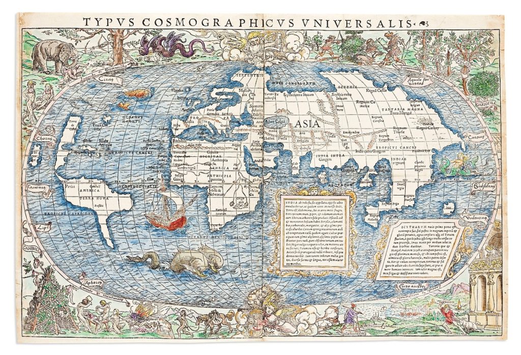
Sebastian Münster’s and Hans Holbein’s Typus Cosmographicus Universalis of 1532, a hand-colored decorative woodcut map of the world on two joined sheets, earned $16,250.
The American Revolution was represented by a scarce book by Charles Smith titled The Monthly Military Repository. Respectfully Inscribed to the Military of the United States of America. It realized $12,500, more than twice its high estimate, featuring engraved frontispiece portraits of generals George Washington and Anthony Wayne, an engraved view of Quebec and eight engraved folding maps and battle-plans.
Two notable lots of early American cartography zoomed in on post-Revolutionary War Baltimore, Md., and the Great Lakes region. Fetching $8,125 was an 1801 Baltimore city plan by Charles Varle, William Warner and Andrew Hanna. Plan of the City and Environs of Baltimore was a large, engraved city plan on wove paper, 20¼ by 30 inches, testifying to Baltimore’s significant growth in the decades following the Revolutionary War. Defined is the downtown area’s original street grid and roads leading out of town, wharves extending into the upper basin, and a key included a 28-point legend of public buildings or landmarks. In the rural reaches beyond the city, the land is peppered with scores of named property owners and their estates.
Bid to the same price was a scare early issue by David William Smyth, surveyor general, a Map of Upper Canada, Describing All the New Settlements, Townships, &c. with the Countries Adjacent from Quebec to Lake Huron. The large, engraved map of southern Ontario Province on the Canadian side and New York, Vermont and parts of New Hampshire, Massachusetts, Connecticut, Pennsylvania and Michigan Territory on the American side measured 22¼ by 34¾ inches overall, and was segmented and mounted to original linen, folding into the publisher’s roan-backed marbled paper case.
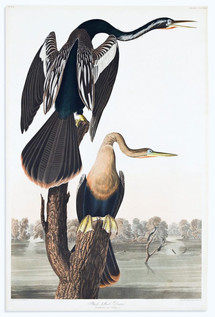
John James Audubon’s “Black Bellied Darter,” Plate CCCXVI, London: Robert Havell, 1836, a hand-colored aquatint and engraved plate from Birds of America on wove paper, went out at $21,250.
American natural history was marked by John James Audubon’s “Black Bellied Darter,” Plate CCCXVI, London: Robert Havell, 1836, a hand-colored aquatint and engraved plate from Birds of America on wove paper. It was 36¾ by 24¼ inches sheet size and went out at $21,250.
Notable world atlases and maps included Abraham Ortelius’ and Frans Hogenberg’s bound collection of Sixteenth Century maps comprising 17 folded double-page engraved maps; Antwerp and Cologne, 1570s-80s, which brought $18,750; and Sebastian Münster’s and Hans Holbein’s Typus Cosmographicus Universalis of 1532, a hand-colored decorative woodcut map of the world on two joined sheets, which earned $16,250.
Prices given include the buyer’s premium as stated by the auction house. For further information, www.swanngalleries.com or 212-254-4710.
